Planning Reports
It is becoming more and more common for planning authorities to ask for specialist reports to be submitted along with planning applications. Whilst it is not always the case, we can help you with getting the necessary information together to gain a planning approval. We provide a complete planning service via Plans for Planning or we can supply the plans for you to do your own planning application.


Planning Reports that ‘could’ be required.
Many if not all of these reports may not be necessary, however we believe that some authorities are asking for reports to give themselves more time to determine an
application and if the report is not submitted they will automatically refuse an application purely on the grounds that a requested report was not submitted. This
would of course give a great advantage at appeal - if it could be proven!
Some reports are easy to check if they are ‘likely’ to be asked for such as a flood report - if you live at the top of a hill, you are obviously going to be highly unlikely to
suffer from a flood - Flood Risk maps can be found on the Gov website.
Ecology Report
Often referred to as an Ecological Impact Assessment (EcIA) or Preliminary Ecological Appraisal (PEA), is a crucial document in the UK planning and development process. Its primary purpose is to identify, assess, and address the potential impacts of a proposed development or activity on the local flora and fauna, their habitats, and wider ecosystems.What is an Ecology Report?
It's a professional document prepared by a qualified ecological consultant that: • Identifies and surveys the habitats and species present on and around a development site. • Evaluates the ecological value of these features (e.g., are there protected species, important habitats, or designated sites?). • Assesses the potential direct and indirect impacts of the proposed development on these ecological features. • Recommends measures to avoid, mitigate, or compensate for any identified negative impacts. • Proposes opportunities for ecological enhancement. • Ensures compliance with relevant wildlife legislation and planning policy.When is an Ecology Report Required?
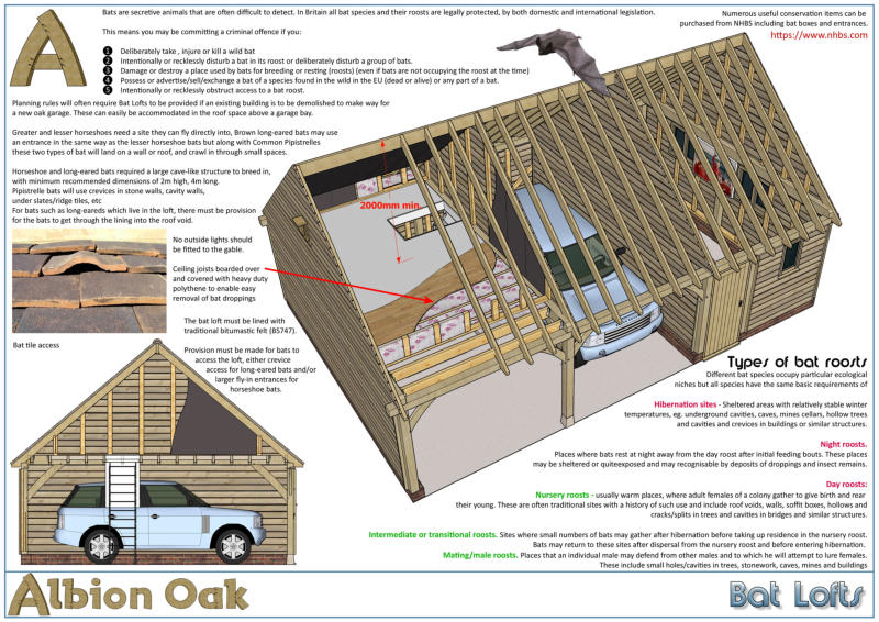
An ecology report is typically required as part of a planning application when there's a reasonable likelihood that a development: • Could affect protected species (e.g., bats, great crested newts, badgers, dormice, nesting birds, reptiles). • Could impact designated sites for nature conservation (e.g., SSSIs, Local Nature Reserves, Special Areas of Conservation - SACs, Special Protection Areas - SPAs). • Involves the removal of important habitats (e.g., ancient woodland, hedgerows, ponds, traditional orchards). • Is located in an area identified as having ecological value by the local planning authority. • The National Planning Policy Framework (NPPF) in England requires planning decisions to contribute to and enhance the natural environment, which often necessitates an ecological assessment.Who Produces It?
Ecology reports are produced by qualified ecological consultants. These professionals have expertise in botany, zoology, habitat classification, wildlife law, and planning policy. They typically hold relevant licenses (e.g., for protected species) and are members of professional bodies like the Chartered Institute of Ecology and Environmental Management (CIEEM).Key UK Legislation and Policy Influencing Ecology Reports:
• Wildlife and Countryside Act 1981 (as amended): Protects wild birds, animals, and plants. Makes it an offence to intentionally kill, injure, disturb, or destroy the breeding sites/resting places of many species. • Conservation of Habitats and Species Regulations 2017 (the 'Habitats Regulations'): Implements the EU Habitats and Birds Directives in the UK, providing strict protection for European Protected Species (EPS) and designated Natura 2000 sites (SACs and SPAs). • Natural Environment and Rural Communities (NERC) Act 2006: Places a duty on all public authorities (including local planning authorities) to have regard to conserving biodiversity in exercising their functions. It also lists "species of principal importance" and "habitats of principal importance" for biodiversity conservation in England. • National Planning Policy Framework (NPPF): Sets out the government's planning policies for England and how these are expected to be applied. Chapter 15 specifically deals with conserving and enhancing the natural environment, requiring ecological information to be submitted with planning applications where impacts on biodiversity are likely.Stages of an Ecology Report (Typical Process):
The ecological assessment often follows a staged approach:Stage 1: Preliminary Ecological Appraisal (PEA) / Phase 1 Habitat Survey:
• Desk Study: Reviewing existing ecological data, designated sites, protected species records, and relevant mapping for the site and surrounding area. • Site Walkover (Phase 1 Habitat Survey): A detailed survey of the site to identify and map habitat types, assess their ecological value, and identify features that could support protected species (e.g., mature trees for bats, ponds for great crested newts, scrub for nesting birds). • Output: A PEA report is produced. It identifies potential ecological constraints and opportunities, and crucially, recommends whether further, more detailed surveys are required.Stage 2: Targeted Protected Species Surveys (Phase 2 Surveys):
If the PEA identifies a reasonable likelihood of protected species being present or impacts on them, specific surveys are then commissioned. These are often seasonal.Common examples include:
• Bat Surveys: Emergence/re-entry surveys (dusk/dawn), activity surveys, roost inspections. • Great Crested Newt (GCN) Surveys: Bottle trapping, torching, egg searching, eDNA analysis. • Badger Surveys: Identifying setts, snuffle holes, foraging signs. • Bird Surveys: Breeding bird surveys, wintering bird surveys. • Reptile Surveys: Tin/felt tile refugia searches, basking counts. • Dormouse Surveys: Nest tube surveys, nut searches. • Botanical Surveys: Detailed plant community surveys for specific habitats. • Invertebrate Surveys: Pitfall traps, sweep netting, identification.Stage 3: Ecological Impact Assessment (EcIA):
Once all necessary surveys are complete, the EcIA comprehensively assesses the predicted impacts (positive and negative, direct and indirect, short-term and long-term) of the development on ecological features.It outlines a mitigation hierarchy:
• Avoidance: Can impacts be avoided altogether (e.g., by redesigning the layout)? • Mitigation: Can impacts be reduced (e.g., sensitive timing of works, translocation of species, specific construction methods)? • Compensation: If impacts cannot be fully mitigated, what compensation is required (e.g., creation of new habitats elsewhere)? • Enhancement: What opportunities exist to improve biodiversity net gain (BNG) on site (e.g., planting native species, installing bird/bat boxes, creating new ponds)?Outcomes and Recommendations:
The final ecology report will typically: • Summarise the ecological baseline of the site. • Detail the findings of all relevant surveys. • Evaluate the ecological value of the features. • Assess the significance of impacts. • Provide a clear set of recommendations for: o Measures to ensure legal compliance (especially concerning protected species). o Specific mitigation strategies. o Compensatory measures (if necessary). o Opportunities for biodiversity enhancement. o Timetables for works, ecological clerk of works (ECoW) supervision.Importance:
Ecology reports are vital for: • Legal Compliance: Preventing criminal prosecution for harming protected species or habitats. • Successful Planning Applications: Local planning authorities will often refuse applications lacking adequate ecological information or those that demonstrate unmitigated harm. • Environmental Protection: Ensuring development proceeds in a way that minimises harm to biodiversity and, ideally, contributes to its enhancement. • Risk Management: Identifying potential ecological constraints early saves time and money by avoiding costly delays or redesigns later in the project.Heritage Statement
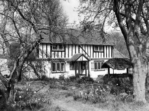
A document that assesses the significance of a heritage asset (or assets) and the impact of a proposed development on that significance. It is a crucial component of planning applications in the UK when a proposed development affects a heritage asset or its setting.What is a Heritage Asset?
In the UK planning system, heritage assets are defined in the National Planning Policy Framework (NPPF) and include: • Designated Heritage Assets: o Listed Buildings: Buildings of special architectural or historic interest. o Conservation Areas: Areas of special architectural or historic interest, the character or appearance of which it is desirable to preserve or enhance. o Scheduled Monuments: Nationally important archaeological sites and monuments. o Registered Parks and Gardens: Historic parks and gardens of special historic interest. o Registered Battlefields: Sites of battles of national importance. • Non-Designated Heritage Assets: Buildings, monuments, sites, places, areas, or landscapes identified by a local planning authority as having a degree of significance meriting consideration in planning decisions, but which are not formally designated. This could include locally listed buildings, archaeological remains, or historic landscapes.Purpose of a Heritage Statement
The primary purpose of a Heritage Statement is to: 1. Identify and describe the heritage asset(s) and its setting. 2. Assess the significance of the heritage asset(s). Significance is about the archaeological, architectural, artistic, or historic interest. 3. Explain the proposed works in detail. 4. Assess the impact of the proposed works on the significance of the heritage asset(s) and its setting. This should consider both positive and negative impacts, direct and indirect effects. 5. Justify the proposed works by explaining why the chosen approach is the most appropriate, demonstrating how harm to significance (if any) will be avoided, minimised, or mitigated. 6. Inform the Local Planning Authority (LPA): Provide the necessary information for the LPA (and often Historic England or other statutory consultees) to make an informed decision on the planning application.When is a Heritage Statement Required?
A Heritage Statement is required for planning applications (and often for Listed Building Consent applications) that propose: • Alterations or extensions to a Listed Building. • Demolition (total or partial) of a Listed Building or any part of a heritage asset. • Development within the setting of a Listed Building, Scheduled Monument, or other heritage asset, where the development could affect its significance. • Development within a Conservation Area (e.g., demolition of an unlisted building, or significant alterations). • Development that may affect archaeological remains (designated or non-designated). • Any proposal impacting a Registered Park and Garden or Registered Battlefield. The requirement for a Heritage Statement is set out in the NPPF (paragraph 194-197) and often detailed further in local planning policies. Local planning authorities typically provide guidance on when one is needed.What Should a Heritage Statement Contain?
While the exact content can vary depending on the nature and scale of the proposed works and the significance of the asset, a comprehensive Heritage Statement typically includes:1. Introduction:
• Description of the proposal. • Location and context of the site. • Identification of all heritage assets affected (designated and non- designated).2. Site Description & Historical Development:
• Physical description of the heritage asset(s). • Detailed historical background and evolution of the asset and its setting. • Analysis of its architectural style, materials, and construction techniques.3. Assessment of Significance:
• A thorough analysis of the heritage asset's significance, drawing on its archaeological, architectural, artistic, and historic interest. This should also consider the contribution of its setting. • This section often breaks down significance into primary and secondary periods, specific features, and views. • References to relevant listings or designations.4. Description of Proposed Works:
• Clear and concise description of the proposed alterations, extensions, or new build. • Explanation of the materials, techniques, and design choices. • Often accompanied by drawings, plans, and photographs.5. Assessment of Impact on Significance:
• Detailed analysis of how the proposed works will affect the identified significance (e.g., will it enhance, preserve, cause harm, or destroy significance?). • Consideration of direct physical impacts and indirect impacts on setting, views, and character. • Categorisation of harm (less than substantial, substantial harm, or total loss of significance) if applicable, as per NPPF.6. Justification & Mitigation:
• Justification for the necessity and appropriateness of the proposed works. • Explanation of how potential harm to significance has been avoided, minimised, or mitigated through design changes, choice of materials, or specialist techniques. • Demonstration of how the proposal will achieve conservation of the heritage asset. • Identification of opportunities for enhancement to the asset or its setting.7. Conclusion:
Summarises the findings and confirms that the proposal is in accordance with national and local heritage policies.Who Prepares It?
A Heritage Statement should be prepared by a suitably qualified and experienced heritage consultant (e.g., a heritage architect, historic buildings consultant, archaeologist, or planner with specialist heritage expertise). They must have a deep understanding of heritage assets, conservation principles, and planning policy.Importance in the Planning Process:
• Legal Requirement: For many projects, it's a statutory requirement. • Informed Decision Making: It provides the local authority with the evidence base needed to understand the heritage implications of a proposal. • Demonstrates Understanding: It shows that the applicant has properly considered the heritage context and is committed to its preservation or enhancement. • Avoids Delays/Refusal: A well-prepared Heritage Statement can expedite the planning process and reduce the likelihood of refusal due to heritage concerns. • Balance of Harm and Benefit: For developments causing some harm, the statement helps demonstrate how that harm is outweighed by public benefits, as required by the NPPF.Structural Report
A Structural Report is a technical document prepared by a qualified structural engineer that assesses the structural integrity, stability, and condition of a building or a specific part of a structure. Its purpose is to provide a professional opinion on the soundness of the structure and often to recommend remedial actions or design solutions.What is a Structural Report?
It's a detailed analysis and assessment that: • Evaluates: The load-bearing elements of a building (e.g., foundations, walls, beams, columns, roofs, floors). • Identifies: Existing or potential structural defects, weaknesses, or areas of concern. • Diagnoses: The cause of any observed problems (e.g., subsidence, settlement, damp, overloading, poor original construction, material degradation). • Recommends: Appropriate solutions, repairs, or design interventions to ensure the structure is safe, stable, and compliant with relevant regulations and standards. • Provides calculations: For new designs or alterations, it includes calculations to demonstrate that the proposed structural elements are adequately sized and configured to safely carry anticipated loads.When is a Structural Report Required?
Structural reports are typically requested in several common scenarios in the UK: 1. Buying or Selling Property: • Prior to Purchase: If a general building survey (like a HomeBuyer Report or Building Survey) highlights potential structural issues (e.g., cracking, bulging walls, significant damp, sagging roofs), a structural report will be recommended to get a specialist opinion. • Selling a Property: To reassure potential buyers or address concerns raised during their surveys. 2. Property Alterations and Extensions: • Removing Load-Bearing Walls: Essential to determine how to safely support the structure above. • Loft Conversions: To assess the adequacy of existing roof timbers and floor joists, and to design new structural elements. • Extensions: To design foundations, lintels, beams, and connections to the existing structure. • Installing Heavy Features: Such as large bi-fold doors, solar panels on certain roof types, or heavy plant on roofs. 3. Visible Defects: • Cracking: Especially large, diagonal, or progressive cracks in walls, floors, or ceilings. • Settlement/Subsidence: Where parts of the building are sinking. • Bulging or Leaning Walls: Indicating instability. • Sagging Roofs or Floors: Suggesting inadequate support or timber decay. • Dampness Issues: Particularly if leading to timber decay (rot) or masonry spalling. 4. Planning and Building Control: • Local authorities and approved inspectors often require structural calculations and drawings as part of Building Regulations applications for new builds, extensions, or major alterations to ensure structural safety. 5. Insurance Claims: After events like subsidence, flood, fire, or impact damage, an insurer may require a structural report to assess the damage and determine necessary repairs. 6. Change of Use: If a building's intended use changes significantly (e.g., from residential to commercial, or office to gym), potentially increasing floor loads.Who Produces It?
Structural reports are prepared by qualified and experienced Structural Engineers. In the UK, they are typically chartered members of professional bodies such as: • The Institution of Structural Engineers (IStructE) • The Institution of Civil Engineers (ICE) Their expertise includes understanding load paths, material properties, and designing structural elements to withstand various forces.Key UK Regulations and Standards:
Structural engineers in the UK design and assess structures in accordance with: • The Building Regulations 2010 (and subsequent amendments): Particularly Approved Document A (Structure) which sets out the functional requirements for structural safety. • British Standards (BS ENs): A range of standards for specific materials (e.g., BS EN 1992 for concrete, BS EN 1993 for steel, BS EN 1995 for timber). • Eurocodes (BS EN 1990 to BS EN 1999): The suite of harmonised European structural design codes, which have largely replaced older British Standards for structural design. • Industry Best Practice: Drawing on experience and common construction methods.Types of Structural Reports:
While the term "structural report" is general, engineers often provide different types: 1. Visual Inspection Report / Specific Defect Report: • Focuses on a specific area of concern (e.g., cracks in a wall, a sagging roof). • Provides a visual assessment, diagnosis of the cause, and recommended remedial works. Limited or no intrusive investigation. 2. Structural Appraisal / Condition Survey: • A more comprehensive assessment of the overall structural condition of an existing building. • Identifies general structural integrity, potential long-term issues, and maintenance needs. 3. Structural Design Report / Calculations: • Produced for new build projects, extensions, or alterations. • Includes detailed calculations for proposed beams, columns, foundations, etc., proving they meet Building Regulations. • Often accompanied by structural drawings. 4. Insurance Claim Report: • Assesses damage caused by specific events (e.g., subsidence, storm damage) for insurance purposes.What Does a Structural Report Generally Contain?
A typical structural report will include: • Introduction & Scope: What the report covers, the client's request, and any limitations of the inspection (e.g., areas not accessed). • Site Description: Details of the property, its age, construction type, and surrounding environment. • Methodology: How the inspection was carried out (e.g., visual inspection, limited intrusive works if agreed). • Observations & Findings: Detailed description of the observed defects, damage, or areas of concern, often accompanied by photographs and sketches. • Analysis & Diagnosis: The engineer's professional opinion on the cause of the problems. • Recommendations: • Specific remedial works (e.g., underpinning, crack stitching, timber repairs, new steel beams). • Further investigations if necessary (e.g., ground investigations, monitoring). • Maintenance advice. • Conclusions: A summary of the structural integrity and any immediate risks. • Disclaimers & Limitations: Important caveats regarding hidden defects or areas not inspected. • Calculations & Drawings (if applicable for design work).Importance:
Structural reports are essential for: • Safety: Ensuring buildings are structurally sound and safe for occupation. • Compliance: Meeting legal requirements under Building Regulations. • Financial Protection: Identifying costly structural issues before purchase or before they worsen, saving significant money in the long run. • Informed Decision-Making: Providing clear, expert advice for property owners, buyers, and developers to make sound decisions about their assets. • Insurance & Litigation: Providing expert evidence for claims or disputes.Water Reports
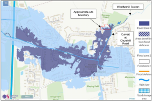
A Surface Water Report, in the context of planning and development in the UK, is most commonly understood to be a Flood Risk Assessment (FRA), or a specific part of a broader drainage strategy that focuses on the management of surface water runoff from a proposed development. Its primary goal is to demonstrate that a development will be safe from flooding, will not increase flood risk elsewhere, and ideally, will reduce flood risk overall.What is a Surface Water Report (Flood Risk Assessment - FRA)?
A Flood Risk Assessment is a systematic study that: • Identifies: The sources of flood risk to a site (e.g., rivers, sea, groundwater, surface water, sewers, reservoirs). • Assesses: The likelihood and potential consequences of flooding from these sources for the proposed development. • Proposes: Appropriate measures to manage and mitigate flood risk, both to the site itself and to areas upstream and downstream, ensuring there is no net increase in flood risk elsewhere. • Develops a Surface Water Drainage Strategy: A crucial component of an FRA is often the detailed plan for managing surface water runoff from the development site, typically incorporating Sustainable Drainage Systems (SuDS).When is a Surface Water Report (FRA) Required?
An FRA is typically required by the Local Planning Authority (LPA) as part of a planning application in the UK, particularly in line with the National Planning Policy Framework (NPPF), when: 1. The development is in Flood Zone 2 or 3: These are areas identified by the Environment Agency (EA) as having a medium or high risk of flooding from rivers or the sea. You can check flood zones on the government's flood map for planning. 2. The development is in Flood Zone 1 (low risk) but: • It is over 1 hectare (10,000 sq m) in size. • It is located in an area identified by the LPA as being susceptible to surface water flooding (e.g., shown on a local Strategic Flood Risk Assessment - SFRA). • It involves a change of use to a more vulnerable class (e.g., from industrial to residential, or creating a basement dwelling) even if the site is small. • It is located in a critical drainage area as identified by the LPA. 3. The development is near a watercourse or culvert: Even if not in a designated flood zone, works close to rivers, streams, or large culverts may require an FRA.Who Prepares It?
A Surface Water Report (FRA) is prepared by qualified engineers or environmental consultants with expertise in hydrology, hydraulics, and drainage design. They have the technical knowledge to assess flood risk, perform necessary calculations, and design effective drainage solutions.Key UK Policy and Guidance:
• National Planning Policy Framework (NPPF): Chapters 14 (Meeting the challenge of climate change, flooding and coastal change) and 15 (Conserving and enhancing the natural environment) are key. The NPPF applies a "sequential test" and "exception test" to steer development away from high flood risk areas. • Planning Practice Guidance (PPG) - Flood Risk and Coastal Change: Provides detailed guidance on how to apply the NPPF policies, including requirements for FRAs. • Building Regulations Part H (Drainage and Waste Disposal): Sets out requirements for surface water drainage from buildings, generally promoting permeable surfaces and discharge to infiltration systems where possible. • Sustainable Drainage Systems (SuDS) Manual (CIRIA C753): The leading industry guidance on the design, construction, and management of SuDS. • Lead Local Flood Authorities (LLFAs): Councils that manage local flood risk from surface water, groundwater, and ordinary watercourses. They are statutory consultees for major planning applications and often have their own local policies and requirements for surface water management plans. • Environment Agency (EA): Responsible for flood risk from main rivers and the sea, and a statutory consultee for major developments in Flood Zones 2 and 3.What Does a Surface Water Report (FRA) Generally Contain?
A comprehensive FRA typically includes: 1. Site Description: Location, existing use, proposed development, ground levels. 2. Sources of Flood Risk: Identification and assessment of all potential flood sources (fluvial, tidal, pluvial/surface water, groundwater, sewer, reservoir). 3. Flood Zone Classification: Confirmation of the EA Flood Zone for the site. 4. Sequential and Exception Tests (if applicable): A demonstration that the sequential test has been applied (i.e., less vulnerable development has been steered to lower flood risk areas) and, if in Flood Zone 3, the Exception Test has been met (i.e., the benefits of the development outweigh the flood risk). 5. Assessment of Flood Risk to the Development: Analysis of potential flood depths, velocities, and durations. 6. Surface Water Drainage Strategy: • Existing Drainage: How surface water is currently managed on the site. • Proposed Drainage: Detailed proposals for managing surface water runoff from the new development. This is where SuDS are central. o Runoff Rates: Calculations of pre- and post-development runoff rates. The aim is always to achieve a reduction, or at least no increase, in runoff rates, typically to greenfield runoff rates. o Storage Volumes: Calculation of required attenuation (storage) volumes to manage peak flows during storm events. o Discharge Point: Proposed method and location of discharge (e.g., to ground via infiltration, to a watercourse, to a sewer). The hierarchy of discharge preference is infiltration > watercourse > sewer. o SuDS Features: Specific details of proposed SuDS components (e.g., permeable paving, swales, rain gardens, detention basins, green roofs, soakaways). o Maintenance & Management: Plans for the long-term maintenance of the drainage system. 7. Mitigation Measures: Recommendations for protecting the development from flooding (e.g., raising finished floor levels, flood resilient/resistant construction). 8. Off-site Impacts: Confirmation that the development will not increase flood risk elsewhere. 9. Climate Change Allowance: All assessments must incorporate appropriate allowances for climate change impacts on rainfall intensity and sea levels. 10. Emergency Plan: Outline of a flood evacuation and management plan for the site users. 11. Conclusion: Summary of findings and confirmation of compliance with relevant policies.Importance:
• Safety: Ensures the proposed development will be safe for its occupants from flood risk. • Environmental Protection: Prevents new development from exacerbating flood risk in surrounding areas. • Planning Permission: A robust and compliant FRA is essential for securing planning permission for developments in or near areas of flood risk. • Sustainability: Promotes the use of sustainable drainage practices that benefit water quality, biodiversity, and amenity.Community Infrastructure Levy
The Community Infrastructure Levy (CIL) is a charge that local authorities in England and Wales can choose to levy on new development in their area. It's a way for councils to raise funds from developers to help fund infrastructure that is needed to support growth and development.What is the Purpose of CIL?
The primary purpose of CIL is to: • Fund Infrastructure: Provide funding for a wide range of infrastructure projects that are needed as a result of development. This can include: o Roads and other transport facilities (e.g., public transport, cycleways). o Flood defences. o Schools and other educational facilities. o Healthcare and social care facilities. o Parks, green spaces, and play areas. o Sporting and cultural facilities. o Community facilities (e.g., community halls, police stations). • Provide Certainty: Offer developers more certainty about what they will be expected to contribute towards infrastructure, speeding up the development process compared to the more negotiated Section 106 agreements (though S106s still exist for site-specific mitigation). • Share Financial Gain: Ensure that those who benefit financially from obtaining planning permission contribute to the wider community that accommodates the development.How is CIL Calculated and When Does it Apply?
• • Local Authority Decision: CIL only applies in areas where a local authority (known as a "charging authority") has formally adopted a CIL Charging Schedule. This schedule sets out the specific CIL rates for different types of development and different geographical areas within their jurisdiction. • Liability Trigger: CIL is generally charged on new or additional gross internal floor space (GIA). o New dwellings: Any new house or flat is potentially liable for CIL, regardless of its size. o Other development: Most other new development (e.g., commercial, retail) is liable if it creates 100 square metres or more of net additional internal floor space. • Calculation: The CIL charge is calculated per square metre of net additional floor space. The formula involves: o The CIL rate from the local authority's Charging Schedule (e.g., £X per square metre). o The net additional GIA of the development. o An index linking factor (RICS CIL Index) to adjust the rates for inflation from when the charging schedule was adopted to when planning permission is granted. o Deductions can often be made for the GIA of existing buildings that have been in continuous lawful use for at least six months within the last three years, provided they are to be demolished or re-used as part of the new development. • Payment Timing: o Liability Notice: Once planning permission is granted, the local authority issues a CIL Liability Notice, stating the estimated charge. o Assumption of Liability: A party (usually the developer or landowner) must formally 'assume liability' for the C CIL payment. o Commencement Notice: Before starting work on the development, a 'Commencement Notice' must be submitted to the local authority. o Demand Notice: Upon receipt of the Commencement Notice, the local authority issues a Demand Notice, confirming the final amount due. o Payment Due: CIL becomes payable on the commencement of the development. Payments can often be made in instalments, depending on the local authority's policy and the size of the charge.Who Pays CIL?
The responsibility for paying CIL generally rests with the landowner, but often the developer assumes liability. If no one assumes liability, it defaults to the landowner(s).Reliefs and Exemptions:
Various forms of relief and exemption from CIL may be available, but strict criteria and application processes apply, and these must usually be applied for before development commences: • Residential Annexes and Extensions: Can be exempt if certain conditions are met (e.g., within the curtilage of a dwelling, occupied by the homeowner). • Self-Build Houses and Flats: Owners building their own homes may be exempt. • Social Housing: Development for social housing is generally eligible for relief. • Charitable Development: Development for charitable purposes may be exempt. • Exceptional Circumstances Relief: In rare cases, if a CIL charge would make a development unviable, exceptional relief might be granted (if the local authority has adopted such a policy).How is CIL Spent?
• Local authorities are legally required to spend CIL funds on infrastructure needed to support the development of their area. • They must identify the types of infrastructure they intend to fund, often published in an Infrastructure Funding Statement (IFS) annually. • A "meaningful proportion" (typically 15% or 25% if there is an adopted Neighbourhood Plan) of CIL revenues collected from development within a specific neighbourhood area must be passed to the relevant Parish or Town Council (or directly spent in that neighbourhood by the LPA if there's no parish council). This is often called the "neighbourhood portion" and gives local communities a direct benefit from development. • The remainder is spent by the main charging authority on infrastructure across its wider area. • CIL funds cannot typically be used for providing affordable housing (which is usually secured via Section 106 agreements).Landscape and Visual Impact Assessment (LVIA)
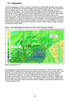
A Landscape and Visual Impact Assessment (LVIA) is a systematic process used to identify, predict, and evaluate the effects of change resulting from a development on the landscape and on people's views. It is a crucial document in the UK planning process, especially for larger or more sensitive developments that could significantly alter the character of a landscape or the visual amenity of an area.What is an LVIA?
An LVIA is a formal assessment prepared by a landscape architect or a qualified landscape consultant. It involves: 1. Landscape Character Assessment: Understanding the existing landscape character of the site and its surroundings. This considers the combination of natural elements (geology, topography, vegetation, water features) and cultural elements (land use, settlement patterns, historical features, field boundaries) that give an area its distinct sense of place. 2. Visual Amenity Assessment: Identifying and assessing the views people have from various locations (called "viewpoints") towards the proposed development. This considers who is looking (receptors), what they see, how sensitive their view is, and how the development will alter that view. 3. Impact Assessment: Evaluating the potential effects of the proposed development on both the landscape character and the visual amenity, distinguishing between direct and indirect, temporary and permanent, and beneficial and adverse impacts. 4. Mitigation and Enhancement: Proposing measures to avoid, reduce, or compensate for negative impacts, and to enhance the landscape and visual experience where possible.Purpose of an LVIA:
• Inform Planning Decisions: Provides objective information to the local planning authority (LPA) and other stakeholders (e.g., statutory consultees, local communities) about the landscape and visual implications of a development. • Comply with Planning Policy: Helps demonstrate compliance with national (NPPF) and local planning policies related to landscape, visual amenity, and environmental protection. • Identify Constraints and Opportunities: Helps developers understand the landscape and visual sensitivities of a site early in the design process, allowing for design iterations that minimise harm and maximise benefits. • Justify Design Choices: Explains why certain design choices were made in response to the landscape context. • Aid Public Consultation: Provides clear visualisations and descriptions that can be used to explain the proposed changes to the public.When is an LVIA Required?
An LVIA is typically required for planning applications when a development: • Is large in scale (e.g., housing estates, industrial parks, renewable energy developments like wind farms or solar farms). • Is located in or near a designated landscape (e.g., National Parks, Areas of Outstanding Natural Beauty - AONBs, National Scenic Areas in Scotland, Conservation Areas, Green Belt). • Is in a prominent location, highly visible from public viewpoints, or could affect significant views. • Involves changes to topography, vegetation, or landform that could alter the landscape character significantly. • Is likely to have an impact on the setting of heritage assets (e.g., Listed Buildings, Scheduled Monuments) where their setting is part of their significance. • As part of an Environmental Impact Assessment (EIA), where landscape and visual effects are often a key environmental topic. The need for an LVIA is often determined by the LPA through a scoping opinion or by the developer's initial assessment of potential impacts.Key Guidance and Policy in the UK:
• National Planning Policy Framework (NPPF) (England): Chapter 15 ("Conserving and enhancing the natural environment") is particularly relevant, emphasizing the protection and enhancement of valued landscapes and the importance of good design. • Guidelines for Landscape and Visual Impact Assessment (GLVIA) 3rd Edition: Published by the Landscape Institute and IEMA (Institute of Environmental Management & Assessment), this is the authoritative technical guidance for conducting LVIAs in the UK. It sets out the methodology, terminology, and best practice for the assessment process. • Local Planning Policies: Local Development Plans and Neighbourhood Plans often contain specific policies regarding landscape character, visual impact, and design within their area.What Does an LVIA Generally Contain?
A typical LVIA report follows a structured methodology (as per GLVIA3) and includes: 1. Introduction: Project overview, LVIA scope, and methodology. 2. Description of the Proposed Development: Detailed description of the development's components, scale, layout, materials, and associated works (e.g., access roads, lighting). 3. Baseline Landscape Assessment: • Desk Study: Review of relevant policy, designations, landscape character assessments (national, regional, local), and mapping. • Field Study: On-site verification, identification of specific landscape features, elements, and characteristics. • Landscape Character Areas/Types: Delineation and description of relevant landscape character areas. • Sensitivity: Assessment of the sensitivity of the landscape to the proposed change. 4. Baseline Visual Assessment: • Identification of Visual Receptors: Who sees the site (e.g., residents, road users, walkers, tourists). • Identification of Viewpoints: Selection of representative, specific, and sometimes illustrative or sensitive viewpoints. • Sensitivity: Assessment of the sensitivity of the visual receptors to the proposed change. 5. Assessment of Landscape Effects: • Analysis of how the development will affect the elements, characteristics, and overall character of the landscape. • Consideration of direct effects (e.g., loss of trees, earthworks) and indirect effects (e.g., new patterns of movement, light pollution). 6. Assessment of Visual Effects: • Analysis of how the development will affect views from the selected viewpoints and for different visual receptors. • Often supported by visualisations (photomontages, wireframes, CGIs) to illustrate the predicted changes. 7. Mitigation and Enhancement: • Proposals for measures to avoid, reduce, or compensate for adverse impacts (e.g., sensitive siting and design, appropriate landscaping, tree planting, use of sympathetic materials). • Identification of opportunities to enhance landscape character and visual amenity (e.g., creation of new green infrastructure, public access improvements). 8. Cumulative Effects Assessment (if applicable): Assessment of how the proposed development's impacts combine with those of other existing or proposed developments in the area. 9. Conclusions: Summary of significant effects and confirmation of compliance with policy and best practice.






















© 2016
Planning Reports
It is becoming more and more common for planning authorities to ask for specialist reports to be submitted along with planning applications. Whilst it is not always the case, we can help you with getting the necessary information together to gain a planning approval. We provide a complete planning service via Plans for Planning or we can supply the plans for you to do your own planning application.


Permitted Development
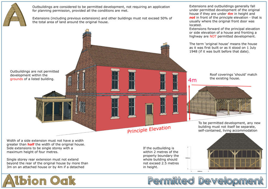
Buildings which are behind the principle elevation of your property and under 4m in height can usually be built under permitted development. We have a range of standard designs which fall under permitted development or we can design something to suit. You can apply for a Lawful Development Certificate if you want some paperwork to prove that your building is allowed under permitted development rules. Some people might like to see some evidence that your building complies if you sell your property but it’s not a necessity.When Does Permitted Development Apply?
An oak-framed building, such as a garage, garden room, or extension, may qualify under permitted development if it complies with the following guidelines:Purpose and Usage:
• The building must be incidental to the main dwelling (e.g. a garage, home office, gym or storage). • Living accommodation, such as an annex, often requires planning permission.Size Limits:
• The maximum height is 4 metres for dual-pitched roofs or 3 metres for other roof types. • Eaves height cannot exceed 2.5 metres if within 2 metres of a boundary. • Total ground area covered by outbuildings must not exceed 50% of the land around the original house.Location Restrictions:
• The structure must not be in front of the principal elevation of your home. • It must maintain appropriate distance from boundaries. • Some areas, such as conservation zones, national parks, or listed properties, have stricter controls.Special Designations:
• For properties within areas of outstanding natural beauty (AONB) or similar zones, restrictions on size and placement may apply.Roof Design:
• Flat roofs are restricted to a maximum height of 3 metres. • Balconies or raised platforms are not permitted under permitted development. To ensure your oak-framed project meets permitted development requirements, contact our team today. We’ll guide you through the process, offering tailored advice to bring your vision to life - whether it’s under permitted development or through a successful planning application.
 About
About
 Products
 Quotations
 Technical
 News
News
 Blog
Blog
 Inspiring Oak Frame Extension Ideas for Your Home
- Which Extension Style Should You choose?
 Jungle of Regulation Is Choking Small-Scale Development
 Is an Oak Frame Conservatory the Perfect Extension for Your Home?
 Oak Frame Flat Roof Extensions
 What should I consider when designing an oak frame extension?
 Contact
 Frequently Asked Questions
 Self Build
 Oak Frame Design
 Grades of Oak
 Longevity of Oak
 Services
 The Process
 Design Requirements
 Site Preparation
 Sustainability
 Construction Methods
 Feasibility Study
 Gallery
 Garages
 Single Storey Garages
 Two Storey Garages
 Garage Complexes
 Extensions
 Garden Rooms
 More Info
 Conservatories
 More Info
 Traditional Orangeries
 Mansard Orangeries
 Garden Buildings
 Annexes
 Entertainment Spaces
 Home Offices
 Shelters
 Pool Buildings
 Stables
 House Designs
 Commercial
 Barn Buildings
 Sport Buildings
 Bespoke Buildings
 Single Storey Garage
 Two Storey Garage
 Garden Rooms, Orangeries & Offices
 Design
 Architectural Design
 Case Studies
 Oak Framing History
 Glossary of Oak Framing
 Oak Patina
 Garage Frame Sections
 Cladding
 Planning
 Planning Reports
 Building Regulations
 Non-Designated Heritage Assets
 Caravan Sites
 Groundworks
 Assembly
 Supply Only Kits
 Turnkey Projects
 Joinery
 Glazing Options
 Lanterns
 Roof Works
 Roof Styles
 Roof Trusses
 Roof Tiling
 Albion Oak
 Employee of the Month
menu html5 by Css3Menu.com


© 2016 - Need help? Contact us on 07967 778808
